---
---
--:--:--PM
--:--:--PM
Raleigh–Durham Airport (RDU) airport maps
Maps over Raleigh–Durham Airport, USA
Interactive airport map
This is a zoomable map over Raleigh/Durham (RDU). The map can give you an overview of the outdoor area with terminals, parkings and on some airports also details of gates, car rental facilities and other amenities if you zoom in.
The map is maintained by the OSM community via open collaboration. Links to other map services:
Openstreetmap Google Maps (Satellite) Bing maps (Satellite) Google street viewRaleigh–Durham Airport routes & destination map
Map of all passenger routes from Raleigh/Durham (RDU). This airport has approximately 74 destinations.
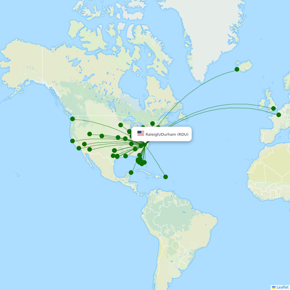 Click to view a list of destinations from Raleigh/Durham (RDU) together with a route map.
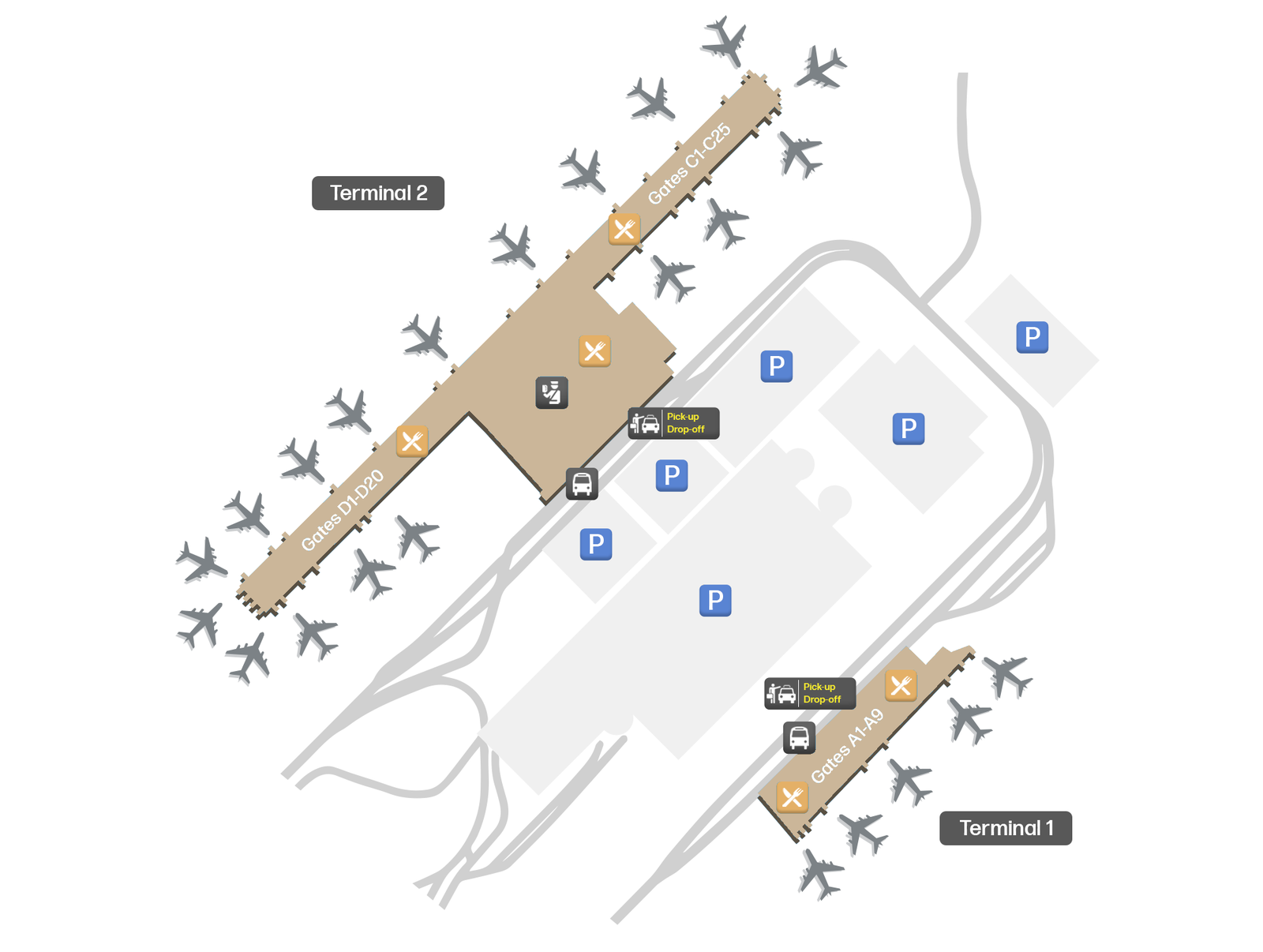
Terminal overview
Illustration of the airport terminal(s) concourses and gates.
 Click to open a larger image in a new window.


